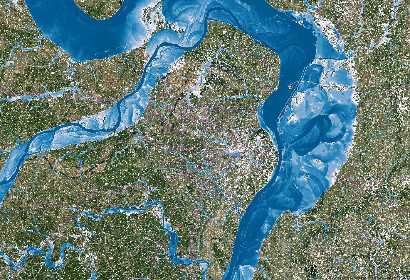
In this NPR podcast, Dag Lohmann describes how his startup company called KatRisk is using the Titan supercomputer at ORNL to create detailed flood maps for use by insurance companies.
KatRisk is a catastrophe modeling company focused on flood and wind risk. KatRisk develops event-based probabilistic models to quantify portfolio aggregate losses and exceeding probability curves. Their goal is to develop models that fully correlate all sources of flood loss including explicit consideration of tropical cyclone rainfall and storm surge.

Why is supercomputing required? KatRisk is setting out to risk-map most of the planet.
The first stage in our product development process is the creation of flood hazard risk maps at multiple return periods. We have completed development of risk maps for the US and a large portion of Asia and will have much of the world covered by the end of 2015. Our flood risk data allows for the assessment on individual location risk including risk pricing.
As an incentive for startup companies like KatRisk, computer time on the Oak Ridge computer is free.
As a national lab, Oak Ridge was directed by Congress to provide access to its supercomputer to researchers “in United States industry, institutions of higher education, national laboratories and other federal agencies.”