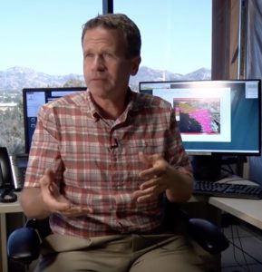
Alex Tardy from the National Weather Service
In this KPBS video, firefighters in the field tap an SDSC supercomputer to battle wild fires.
Local fire officials started using a new tool called WIFIRE in September. WIFIRE is a sophisticated fire modeling software that uses real-time data to run rapid simulations of a fire’s progress. During the recent Palisades Fire in Los Angeles, WIFIRE helped crews by providing six-hour predictions of where the fire was headed.
It helps to see where the fire is likely going to go,” said Raymond De Callafon, a UCSD engineer who worked on the project. “So, a fire department can use this for planning purposes with their limited resources. It can also be used to plan, maybe their aircraft that will go over. Where to put the fire out.”
As a consortium of UC San Diego organizations, industry partners, fire departments, utilities, and the State’s CalOES and CPUC the WIFIRE Lab conducts research and development towards infrastructure, services and tools for artificial intelligence integrated fire science:
- Intelligent infrastructure for data fusion: Our research and expertise in data and knowledge systems, workflow automation at the computing continuum, machine learning and artificial intelligence, and signal processing, positions us with unique capabilities to harness the power of large-scale and complex geospatial and time-series data to benefit the fire science community. WIFIRE Cyberinfrastructure provides uniquely innovative and powerful capabilities to catalog, curate, integrate, exchange, analyze and communicate public and private data. Our data services are built in an interoperable form that can be ingested into any REST-enabled analysis and GIS-enabled data ingest platform using open standards.
- Artificial intelligence (AI) tools: We investigate novel ways to exploit advancements in machine learning and artificial intelligence to address problems and data with application to fire science. For example, our work applies deep learning to high-resolution satellite imagery for identification of regions-of-interest for land cover classification. Through the application of data science, we aim to publish and serve the best data for fire science to our community in a real-time and FAIR fashion.
- Automated data-driven fire modeling using scalable workflows: WIFIRE Cyberinfrastructure integrates automated workflows with real-time and data-driven modeling and simulation capabilities to predict, map and visualize wildfire behavior. We integrate advanced data science and signal processing techniques for capturing the dynamics of real-time fire behavior to combine it with physics-based fire models. The infrastructure allows for multiple fire behavior modeling tools and advanced computing environments to be utilized in fire modeling ensembles running on supercomputing and private cloud platforms.
- User interfaces for faster science integration in operational activities: We build user-oriented tools for operational and scientific communities. As an example, Firemap is a web-based fire modeling tool that is easy to use, rapid and accurate, which enables it to disrupt the way fire models are used for fire response. It provides full access to scenario-based and real-time fire modeling functionality. Firemap is designed for rapid deployment starting with the earliest moment that a fire is reported, enabling a fire modeling workflow designed to run in real time, instantaneously.