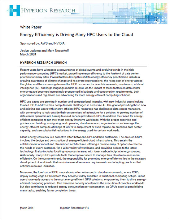
In this video, Michele Taufer from the University of Tennessee describes how AI enabled by HPC allows researchers to study wildfire propagation which enhances predictions and mitigation. “One of the projects her team is working on looks at how to integrate aspects of soil moisture with wildfire simulations. HPC today and machine learning/AI enable us to identify those patterns and extract the knowledge. The data are generated, analyzed at the same time, and then the knowledge extracted by the data is re-injected into the simulation. Our POWER9 system that allow us exactly to do that.”
Supercomputing the Future Path of Wlldfires
October 25, 2019 by
In this KPBS video, firefighters in the field tap an SDSC supercomputer to battle wild fires. Fire officials started using the supercomputer’s WIFIRE tool in September. WIFIRE is a sophisticated fire modeling software that uses real-time data to run rapid simulations of a fire’s progress. It helps to see where the fire is likely going to go,” said Raymond De Callafon, a UCSD engineer who worked on the project. “So, a fire department can use this for planning purposes with their limited resources. It can also be used to plan, maybe their aircraft that will go over. Where to put the fire out.”
Supercomputing Post-Wildfire Water Availability
September 4, 2019 by
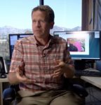
A new study by scientists at Lawrence Berkeley National Laboratory (Berkeley Lab) uses a numerical model of an important watershed in California to shed light on how wildfires can affect large-scale hydrological processes, such as stream flow, groundwater levels, and snowpack and snowmelt. The team found that post-wildfire conditions resulted in greater winter snowpack and subsequently greater summer runoff as well as increased groundwater storage.
The Use of HPC to Model the California Wildfires
April 24, 2018 by

Ilkay Altintas from the San Diego Supercomputer Center gave this talk at the HPC User Forum. “WIFIRE is an integrated system for wildfire analysis, with specific regard to changing urban dynamics and climate. The system integrates networked observations such as heterogeneous satellite data and real-time remote sensor data, with computational techniques in signal processing, visualization, modeling, and data assimilation to provide a scalable method to monitor such phenomena as weather patterns that can help predict a wildfire’s rate of spread.”